Unknown's avatar

Map and Compass

In my book, I‘ve already gone over the California map and at this point, my clients have a good idea of where they are on the planet.

The next map I bring out is the park map that the rangers hand out to everyone at the entrance stations.  I point out the roads and I lay my pinky finger on Yosemite Valley. “This is where 96% of people who come to the park go. They think that if they’ve seen Half Dome, they’ve seen Yosemite.” I do my best imitation of Chevy Chase in National Lampoon Vacation where, at the lip of the Grand Canyon, he puts his arm around his wife, and nods at the view for two seconds, before herding the kids back to the car for the next destination. Smearing my hand over the rest of the map, “From our high vantage points you are going to see it all.” I see smiles of privilege and anticipation.

“This is a nice map if you’re in a car.  You can see the roads, the Visitor Centers, the trails, a few lakes. But it can be deceiving. See how Glacier Point here looks really close to Happy Isles? Well, they are really close… as the crow flies. Two boys told their parents they were going to hike to the ice cream stand at Happy Isles from Glacier Point. They ended up ‘coptered off a ledge because, even if it looks close on the map, it’s 3,000 feet down. If they had a topographical map and knew how to read it, they would never have made that mistake.  

With that, I haul out the custom map I have printed for each of them. I point out the scale, how two inches on the map equals one mile on the land, that the top of the map is the north edge, and that the space between contour lines, the contour interval, is forty vertical feet.

“This map has a lot of squiggly lines all over it. It’s easy to get overwhelmed but I’ll teach you how to read it, what’s important, and what to ignore. In Girl Scouts they teach how to take a potato and slice it vertically, then take each slice in order and draw around it on a piece of paper so there’s a bunch of concentric ovals. They name it Mt. Spud. On our map, the space between each line on Mt. Spud’s slope equals forty feet.” I point out a peak on the map and they see the concentric circles. “That’s what peaks look like. The closer the squiggly lines, the steeper the slope is. This is a good thing to look at when checking out your route to see where it will be a hard uphill, a steep downhill, or an easy stroll.”

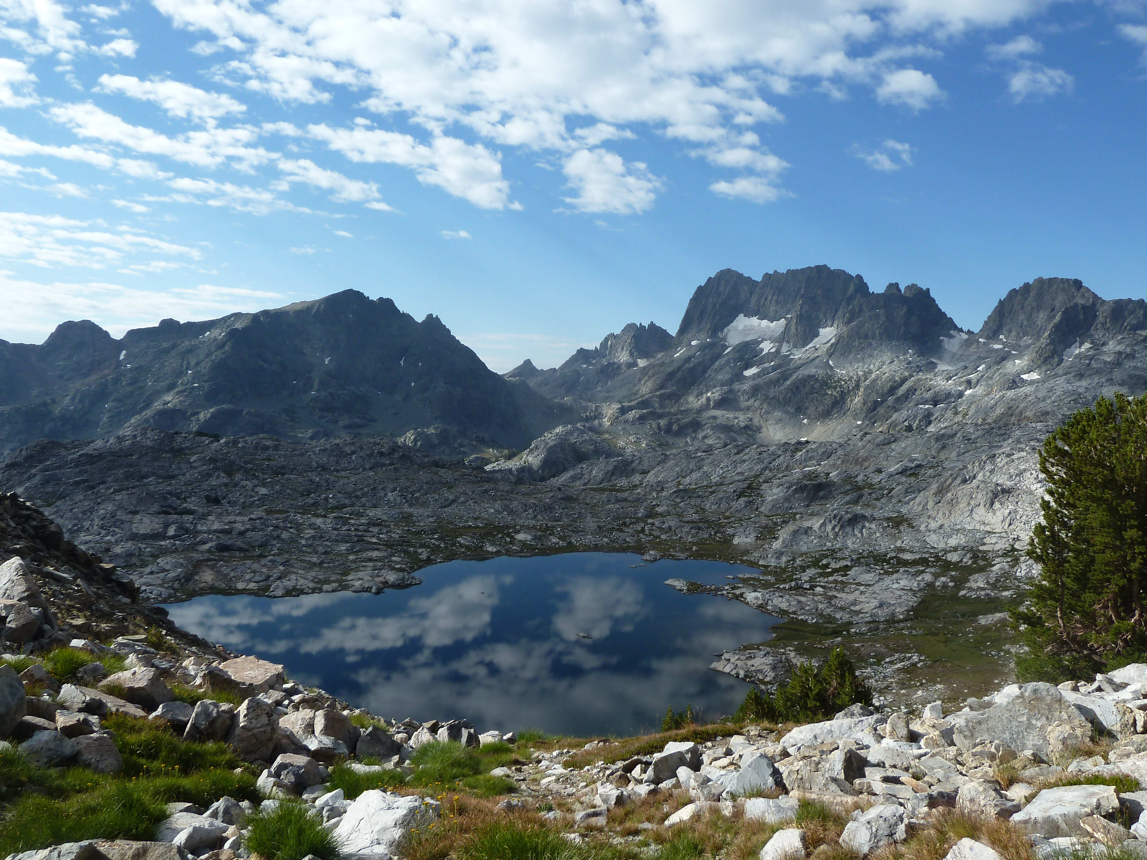
Pointing out the contour interval always reminds me of the eight-day trip I took with friends off-trail on a loop around Mt. Ritter near Mammoth. It was in 2000. I’d had my last day of radiation for breast cancer the day before the trip. I wasn’t in the best of shape and the radiation burns in my armpit had my skin peeling off like the skin off pudding. We’d pieced together four USGS topo maps to cover the area of the trek. Pre-trip, I kept wondering how we were gaining all the altitude to cross 11,000-foot North Glacier and Ritter Passes. I didn’t see it in the steepness represented by the topo lines. Finally, on the last day, I realized that the map covering the peaks, unlike the rest of the area, was all in meters, not feet. The contour interval was 20 meters, not forty feet. The area we were hiking in was all one and a half times as steep as we’d planned!

Holding up my water bottle, “On this planet, water is always in the lowest spots.” Giggling. “Blue blobs surrounded by concentric circles are lakes.” Much nodding. “These blue lines are creeks or rivers. They always flow downhill, and the topo lines always point in a “V” upstream. By looking at the creeks you can tell which way the slope runs – uphill or downhill.

“Now the green is not grass. It’s trees. Maps were initially made by the military for effective engagements, and they marked in green areas with enough trees to hide a battalion (300-1000 soldiers). Most of these white areas on the map are mountainous areas above tree line but there are also flat grassy meadows designated white, because, while they may look green in real life, there are so few trees.  I camp in a hammock strung between two trees, so I like to know where the trees are and aren’t.”

I have them draw our route on the map by following the trail with marking pens, starting where we’ll park our cars at the Cathedral Lake Trailhead, stopping for our first night at Cathedral Lake, and for our second at Sunrise Lake. They follow the steep trail crossing tight contour lines down from the three Sunrise Lakes to the bus stop at the west end of Tenaya Lake where we will hop on and return to our cars. “What about bus fare?”

“You paid it last April fifteenth.”[1]

Next, we step away from the table and I ask, “Anyone have any idea where north is?” Maybe one will know.  Usually none. “This is the most important thing I want you to learn. Get out your compasses. We’re going to find out.”

In the beginning, I used to teach a lot more of everything in a lot more detail. I taught triangulation and how compasses were invented and how to make a simple compass with a leaf, water, and sewing needle, and how to read shadows, the sun, and stars. It wasn’t about me wanting to look smart by how much information I could throw at them. I wanted them to feel like they got their money’s worth, and I feared their disappointment if they felt they didn’t get it. At the end of a trip, I asked them where north was, and no one could tell me. So, I asked myself, What is it I want them to take away with them? I want them to be able to find north. I wanted them to take away something foundationally useful.

Much fumbling and running back to packs. Once in their hands, they hold their compasses tentatively, like they’re some exotic animals they’re not sure which end will bite. “Your compass is like your heart. It tells you where your True North is. Don’t leave home without it.” 

 “Let’s go over the parts of a compass.” From the bottom layer to the magnetic needle in dampening liquid on top, I point out the base plate, the index point, the direction of travel arrow, the bezel, the declination scale, the orienteering arrow, meridian lines, and the magnetic needle.

“First, we’re going to adjust the declination on those compasses that have a declination key.”

Wha?! I can see their brains turning into Maytag washers on spin cycle. “Declination is just a big word that stands for the difference in angle between true north and magnetic north. Remember those little compasses you got as a party favor at birthday parties when you were a kid?” Heads nod. “And little Tommy’s mom got in your face with wide eyes and a freaky red lipstick smile and told you, ‘It’s magic! It always points north?”. The whole group is now a bunch of six-year-olds wearing pointy paper party hats with that itchy elastic band under their chins and I abruptly bring them out of their trance: “Well, they lied! It does not point north. It points to magnetic north!” Like when teaching about where the rivers start, the first time I explained this I was caught off guard by my intensity. 

The first time I, myself, learned this, I was flabbergasted. How could all these adults have lied to generations of children? Did they think we were all stupid? Hell, I didn’t even know what north was! Why didn’t adults take the time to teach me anything? Did they figure that I already knew it? Then I realized that they didn’t even know it themselves. How could they teach it?

Declination totally explained the time, early in my hiking career, when I was sitting on top of the pass between Cascade and McCabe Lakes. No matter how I bent the map, my compass pointed at Mt. Dana still read about fifteen degrees off as compared to my reading on the map. Of course, misinformation, presented convincingly, became a main emotional trigger for me as an adult, and not just from the compass and the drips off snowbanks, but so many things.

. I continue: “Magnetic north is deep within the Canadian Arctic and the magnetic needle on your compass points in that direction. True north is where the North Pole is.” I show them the little symbol in the corner of the map that indicates the degrees of declination for the area covered by the map. “In different areas of the earth, the declination is different. Out here it’s fifteen degrees east. At the longitude of Wisconsin, It’s zero. It’s called the Agonic Line.  And in New York, it’s thirteen degrees west.” I show them a map of the declinations in the US. “So, if you use a compass, check the declination on the map of wherever you are and adjust your compass accordingly. And, the declination is changing over time as the iron core in the Earth moves about fifty km a year toward Russia. It used to be seventeen degrees when I started backpacking. Now it’s fifteen.” Suddenly, our knees wobble like we’re on an unstable spaceship flying through the Universe… We are. 

 “Now everyone, rotate the bezel so that north is at the top of your compass, pointing at the index line. With north pointing forward, put the south end of your compass in your belly button.” It amazes me how unquestioningly everyone does this, as if it’s perfectly normal to put a compass in your belly button. “Rotate your body so that the red magnetic needle lines up with the red-outlined clear orienteering arrow. It looks like a red-roofed shed. We call this putting red in the shed.  For those that don’t have an adjustable compass, line up the needle with fifteen degrees.” Looking at their belly buttons, everyone is now facing true north.

 “Now aim your left arm at true north.” Arms fling straight out. “That’s the direction of the North Pole where Santa Claus lives.” All smiles, they giggle side-eyeing each other, connecting with a deep shared knowing. “Now, point your right arm at fifteen degrees.” I now have twelve people all looking like they’re in the middle of a Tai Chi class. “That’s magnetic north. If you didn’t adjust for the declination, you’d be off by more than a mile after traveling only five miles.” For the first time in their lives, they feel like they have a compass that’s actually helpful. “Now tell me, where south is.” In unison, twelve bodies rotate 180 degrees in . “How about east? west?” My mission is accomplished.

Now, back to the topo map on the picnic table: “Let’s orient the map to the land.” I place the map flat and show how to avoid the metal bolts in the table that can throw off the magnetic needle. With north still pointed to the index point, I place the right edge of the compass, on the east edge of the map and, grabbing a corner of the map, I rotate the whole shebang until red is in the shed. “Now the map is oriented to the land. We are here.” I point at Lembert Dome Picnic Area on the map. Waving my arm to a pointy peak south of us I ask, “What peak is that?”  

Folks gather around and I hear, “Unicorn Peak!”

There’s a lake on that slope but it’s in a depression so we can’t see it. “Where is it and what’s it called?”

“Elizabeth!”

“What peak is that over there?”

“Cathedral!”

“That’s where we’re going today. See the lake next to it on the map? That’s where we’re camping tonight. Now you know more than most of my friends do about map and compass. They mostly sit around and argue about where they are.” Proud smiles and a feeling that they just might be able to handle this trip.

“The other thing I want to teach you is about baselines. No, it has nothing to do with baseball. A baseline is a known entity on the land: a road, a creek, a lake, a trail; something physical that you’ll know if you run into it. On this trip, we will always be traveling south of Highway 120. If you ever get lost, and you won’t, but if you did, you could always point your compass toward north, follow it to the road, put your thumb out, and hitch a ride to a burger at the Tuolumne Grill.” Laughs and relief all around. “Whenever you go hiking, you should plan a baseline you can shoot for, just in case.

OK. Let’s throw our stuff in the car and drive one mile down the road to Cathedral Lakes Trailhead. Pull up behind and follow me.”


[1] No longer free.

Copyright Jan. 14, 2024 by Karen Najarian.

Unknown's avatar

Life with Cancer

            Life with cancer is “interesting”, as my friend, Rich Caviness, says about sketchy across-country routes. His scale runs from interesting to epic. Epic usually includes some risk to life and limb. This cancer journey is “interesting” by the fact that it has unexpected ups and downs, an epic destination, and a rocky way to get there. I haven’t written much about it because the journey is subject to change and I’m afraid it will have made an irreversible creek crossing between the time I write about it and the day after it’s posted and I have to redirect my readers to a new cliffside ramp along with my wailings about it all being so unfair.

Cross-country routes follow no trails and have no lines on maps. A route is a path you make for yourself between points A and B. When backpacking off-trail with my friends, at least I have someone to argue with over where the best route is or even where the next pass is. I remember a specific time when four of us were stopped for lunch sitting in a patch of dark gray metamorphic rocks rimmed with sedges and low-growing wildflowers. Rick and Caviness finished, got up to continue, and Carolyn and I stayed to finish our lunches at a more leisurely pace. A few minutes later when we hoisted our packs and left, the sky started spitting rain and hail. Our destination for the day was just beyond the next pass. We were already mostly up there. We just needed to traverse a bit more fairly level terrain before one last uphill push.

Carolyn and I got separated in the downpour. While there were no trees to get lost behind, there were Volkswagen-size boulders. “Carolyn! Carolyn!” I shouted in the maelstrom. No answer. The pass was straight ahead and there was a lake off to our right in a steep basin below. I was determined to make it over the 10,530-foot pass and down the other side to our day’s destination.

Once out of the huge boulders, I got a good look down to the lake below. It was a good 300 feet below me. Less than half a mile away, the pass was only another 200 feet up. But, there, there by the lake, I could see two dots – tents already set up with their owners, Rick and Caviness, waving their arms and yelling at me to drop down and join them. Carolyn was unpacking her tent, as well. This is not what we’d planned. I was determined not to lose the altitude I had so dearly gained just to avoid hiking in weather. In my rattling raingear, I yelled down at them, “I am not re-climbing this damn slope up from the lake later on! I’ll see you on the other side of the pass!” After much screaming at each other through the storm, I acquiesced and dropped down to the lake only to join my husband in new levels of rain-wet squalor and sweat-drenched gear in his tent below.

The next day broke calm, if not clear. The peaks cradling the lake reached for the sky looking like something out of the Swiss Alps. The sky still had enough moisture to make for a pink sunrise and the way to the pass was washed clean. Looking like a “yard sale” we dried everything out on rocks, packed it up, and carried on, albeit a bit behind schedule.

Clearly, unexpected changes and adaptations happen in life. In stage four cancer, those usually mean that the drug you’ve been taking to keep the cancer at bay is no longer working and you need to switch to a new one and hope it works. This has only happened to me once when Ibrance stopped working after six months and I moved on to Xeloda (Capecitabine). I was devastated beyond words. In pain, I could feel the growing tumors pressing on nerves exiting my spine. I started looking at my will again and swearing at God.

Luckily, I’ve been successfully treated with Xeloda for 2 3/4 years, only needing to deal with the side effects. Only… Even writing this I wonder if I am jinxing my good luck.

I’m seeing my doc every two months now, which seems like a long time to me. I hadn’t seen her for a year when I was diagnosed in January 2020 with tumors all over my spine, ribs, shoulders, liver, and spleen. For my bi-monthly visits, I get my blood drawn for my cancer marker, a protein on my cancer cells that increases when it’s growing and stays stable when it’s being kept in check by the drug. I tentatively check My Chart two days after my blood draw to check my results. Every two months for the last 2 and ¾ years, I’ve breathed a deep sigh of relief that it’s been stable. And then I immediately start wondering if in those last two days, things have gone south. I think I should post something celebratory but then I start wondering if I’ve already crossed that creek and need to find that new cliff-side ramp.

Living with stage four cancer is a hell of a way to live. I’m naturally not an anxious person. From a stressful childhood, I learned to dumb down my anxiety to make it manageable. It’s a habit that has served me well working at a high-stress job as a Clinical Lab Scientist in a hospital and for life’s emergency situations, like when a client had a heart attack on one of my trips. For twenty years I lived with the specter of its return over my head but I managed to stay firmly in the here and now of how healthy and strong I was. I used to say, “The treatment almost killed me. I’m sure it killed all the cancer.” How could I have known it was only hiding in some nook or crook between the rocks and sedges of my soul?

I’ve always dealt with stress by saying to myself, “Well if it’s not life and death, why worry?” Well, cancer IS life and death. And when I think about it, I worry. When I get an ache or pain, I worry. When women drop from my Xeloda Facebook group because it’s stopped working, I worry. And stress and worry are said to be bad for your immune system which fights cancer. Ahhhhhhh!!!

And to make matters worse, (I try not to complain, otherwise, I’d be complaining all day) I came down with Covid on our cruise to Alaska. More swearing at God. Sorry, God, you’re all I’ve got to get angry at. I haven’t yet transcended my challenges to thank Him for them. And don’t hold your breath. I’d be thrashing and hitting something if I had the energy or at least standing at my open front door in my fuzzy slippers yelling at the sky, “What the fuck?!”

Another of my survival tools is to tell myself, “It will get better.” Kinda like the Russians in a 1960s bread line. I find myself saying this at random points in the day, like a mantra. If I start to doubt it, I’ll be in real trouble.

So, lately, I wander around on cracked feet, mostly in my jammies ‘til about 2 pm, half-blind with chemo dry-eye syndrome, dropping things because the Xeloda has erased my fingerprints, blowing my nose, coughing and exhausted from Covid, imploring anyone within hearing distance to just shoot me.  I tested negative five days ago but I’m still weak and miserable. And I restart my weekly chemo regimen Saturday. I have a backpacking permit for July 30. Even if the road is open and clear (it’s a dirt road south of Yosemite) I need to get into shape. Right now, all I can do is pick my Olallieberry patch in the backyard and then collapse in the comfy chair with purple fingers. I don’t want to lose my altitude and descend to that lake but it looks like I’m already there.

Yesterday I accomplished one thing. I hauled boxes of my kids’ children’s books to the post office to mail to their kids. The heavy cardboard boxes fell out of my arms onto a vacant counter while I waited my turn. I bent over to keep from passing out. I explained to a woman behind me, “I’m negative but I’m recovering from Covid.” She jumped back as if I’d struck her.

“I’m immunocompromised,” she replied with fear on her now-masked face.

“Me, too. Chemo and Covid don’t mix well.” She continued to stand about ten feet behind me like I was a leper. I understand her concern. I just needed more compassion and less conviction. The clerk changed her gloves after handing me my receipt.

Hang in there with me. While you’re not traveling this route in my shoes, you can walk beside me in spirit, hear my ranting, smile at the absurdity of it all, and bring more compassion to the world. Thanks.

Unknown's avatar

Everyone’s Gotta be Somewhere.

So I run around like a mad woman, packing, paying bills, tying up loose ends, sending off some last-minute Christmas cards, getting the three dog/house sitters coordinated, and finally hit the hay around mid-night. The alarm sounds off at 5:25 and I’m up to do an abbreviated morning routine before our neighbor drives us to the Lafayette BART station for our one hour ride to the San Francisco Airport. I stare into the mirror hoping I look better when I touch down in New Hampshire to visit with my sister, her family, and my NY transplant son.

All goes well. We’re flying a southern route with a stop in Dallas-Fort Worth and are pleased that we’re avoiding Chicago which has pretty much closed down due to a blizzard the size of my fist on the NOAA website.  The BART train rumbles in just as we reach the platform.  I’m feeling lucky today. Even at the dark hour of 6:20 am the BART car is full of newly groomed but sleepy commuters. Lugging our luggage, my husband and I find separate seats. No problem. I’ll be spending all day on the plane nudging his elbow over onto his side of the armrest.

Was I even through the Caldecott Tunnel when I got the phone call on my cell with a recording telling me my flight was cancelled? I look up to where Rick is sitting and see his body twisted back toward me, his phone to his ear, and his gaping mouth filling the aisle.

In Oakland most folks exit the train and I move up to sit next to Rick to plan our next move. I’m thinking we should just get off, turn around, and go home. Coffee and breakfast at our kitchen table sounds good about now. Rick thinks we should pursue this at SFO. So we screech and rumble on through the tunnel under the bay, which has always given me the creeps, and down the peninsula to SFO. It’s the shortest day of the year, the day the Mayan calendar stops, and there is a hot pink haze burning the sky above Mt. Hamilton to the south. No, the world isn’t ending.  It’s just another day beginning.

Arriving at the American Airlines area, I find an official looking woman in uniform and ask what we should do.  She points to a long line and gives me a card with a phone number on it and says I should call. Now, yesterday I looked at my flight information and noticed I gave my last name twice when I bought my ticket. I called to straighten it out before homeland security straightened me out. I was on hold for an hour and a half. Thank you speaker phone.

We get in line. This is a line of put-off, irate travelers. Maybe they want to concentrate us all in one spot so we don’t contaminate the airport with our angst and frustration bordering on rage. The guy in front of us is there for the second day trying to get to Paris. The guy in front of him is on our flight traveling only to Dallas-Fort Worth. The next flight is Sunday. He doesn’t want to cut two days off his trip and they won’t refund his money. He’s demanding a paid limo home. The guy behind us actually gets through on that number the uniformed lady gave me. So I leave the line to go sit in some comfy chairs and dial the number, myself.

It took awhile to get through and then I was thanked for my patience and put on hold. I was sitting next to an older gentleman who was also on his phone in a conversation peppered liberally with the words “fucking incompetents.” It turns out he was on his second day of travel to some “little town in Northern California” that he couldn’t pronounce, visiting adult children and grand kids, no doubt. I’ve driven to the Oregon border in five and a half hours. I suggested he rent a car… or walk. It would be faster.

While sitting there, I watched a little boy in line just behind my husband, maybe seven years old, put a phone to the side of his head and break down sobbing. The disappointment in the delay to meet someone wrenched his body.  Tears flooded his red, contorted face, he fell to his knees, and his mother dropped to comfort him. They sat there on the floor in line in the airport for at least 10 minutes. The line moved, they both found their feet, but his sobbing continued.

Having finally spoken to someone on the phone and booked on a new flight tomorrow, I joined my husband in line to inform him. But, mainly, I got back in line to comfort this young boy. I wanted him to hear that I was in the same position, that I was disappointed, too, but that we just have to wait, and that it will be OK. It will be OK. Perhaps he was traveling to see a dad he rarely sees. I don’t know. I would have loved to hear this reassurance, that it will be OK, many times when I was a child. But my words were birds that few away. I was no one he knew and my words meant nothing. He remained inconsolable. His disappointment and frustration was painful to watch. It hurts even now as I write this in the comfort of my bear’s nest (my office).  And I find my disappointment nothing compared to his.

Rick and I found our way back onto a BART train bound for home with our neighbor willing to pick us up. We’ll try this again tomorrow.

Copyright by Karen Najarian 12-21-12